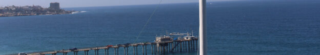
High Frequency (HF) Radar derived surface currents have provided critical support to maritime operations and water quality monitoring since 2005. Currents in the ocean are equivalent to winds in the atmosphere because they move things from one location to another. These currents carry nutrients as well as pollutants, so it is important to know the currents for ecological and economic reasons. The currents carry any floating object, which is why U.S. Coast Guard search and rescue operators use HF radar data to make critical decisions when rescuing disabled vessels and people stranded in the water. These radars can measure currents over a large region of the coastal ocean, from a few kilometers offshore up to about 200 km. A 5-minute video about IOOS HF radar is on Youtube here.
Locations
SCCOOS and CeNCOOS operate 62 HF radars along California's coast. You can access and visualize the data on the California Ocean Observing System data portal!
Ocean Observations
- Surface Currents
- Hourly surface current observations at 6km resolution with a coverage area extending approximately 100 miles offshore.
- Hourly surface current observations at 2km resolution with a coverage area extending approximately 30 miles offshore.
- Hourly surface current observations at 500m resolution. These ultra high resolution currents are available only within San Francisco Bay.
Applications
1. Marine Operations
Oil Spill Response and Recovery: On Tuesday, May 19th, 2015, a ruptured pipeline caused thousands of gallons of crude oil to be released into the ocean along the Santa Barbara coast near Refugio State Beach. HF radar operators were able to install a temporary site to increase local coverage within 24 hours. State and federal emergency responders utilized near real-time surface current data from the radars as the spill extended offshore into the sampling domain for integration of the regional ocean modeling forecasts and NOAA’s operational forecast. HF radar surface currents were also used for post-spill damage assessment modeling. Surface current data from HF radars was similarly used in response to the 2007 Cosco Busan spill in San Francisco Bay.
U.S. Coast Guard (USCG) search and rescue operations: USCG search and rescue operators use near real-time HF radar surface current data and related forecasts for their Search and Rescue Optimal Planning System (SAROPS). The integration of HF radar current data into the SAROPS tool has increased the accuracy of operations by reducing the size of search areas, thereby increasing the overall effectiveness of Coast Guard searches. "Inclusion of the surface currents within our SAROPS tool has significantly improved our search patterns and ability to find someone lost at sea." -Commander Robert Potter, Response Chief and Air Operations Officer.
Coastal recreation: HF radar technology is also useful for coastal recreational activities. Ray Huff and John Ugoretz, co-captains of the 34-foot chartered yacht, the Getaway, plotted their course using wind forecasts and web-based surface current data products in the 61st Newport to Ensenada Yacht Race on 25-26 April 2008 which they won. SCCOOS provided wind forecasts and surface current maps to plot the team’s winning route finishing 1.5 hours ahead of the number two boat in their category. In addition to helping sailors plot their course, mariners, ocean distance swimmers, scuba divers, and recreational boaters also use web-based surface current data products for flow conditions in coastal areas.
2. Water Quality
Tijuana River pollution plume forecasting: Contaminated runoff from the Tijuana River flows along the coastlines of Imperial Beach and San Diego, creating hazardous water conditions that force multiple beach closures and the Navy to halt SEAL Training on Coronado Beach. Surface current data enables the tracking and forecasting of pollution plumes to inform Navy and county officials to close beaches before recruits and civilians are exposed to dangerous water.
Tracking coastal discharge: HF radar surface current data is an important tool for coastal discharge managers under normal operation and during event response. Surface current data is used to evaluate discharge sighting and to respond to wastewater spills. For wastewater spills at the ocean outfall near Ocean Beach, San Francisco in 2007 and at the Marin Sewage District #5 Tiburon Facility in 2008, radar operators provided surface current tracking tools that allowed emergency responders to estimate plume trajectory and more accurately direct clean-up efforts.
3. Ecosystems and Fisheries
Effective Marine Protected Area (MPA) monitoring requires an understanding of changing oceanographic patterns and their implications for MPAs. HF radar data provides state decision-makers with a clear picture of the seasonality of surface currents in and around MPAs and has helped inform the state’s long-term monitoring approach. HF radar surface transport models have been essential for visualizing the predicted path of fish eggs, for example, resulting in a way to measure MPA productivity. SCCOOS developed an online data explorer tool to help partners manage urban runoff and protect the health of Areas of Special Biological Significance.
Surface currents are used to identify and track Harmful Algal Blooms (HABs). The goals are to collect comparable data at five regional stations, provide timely updates on HAB events, and aid in understanding the timing, extent, and impact of these events on humans as well as the ecosystem.
Data Access
- SCCOOS Data Portal
- Google Earth KML (7 day)
- Mapping API (For off-site maps)
- Data Access via CORDC THREDDS Server
- Data Access via NDBC THREDDS Server
- ArcGIS Toolbox
SCCOOS Principal Investigators
- Eric Terrill, UCSD - eterrill @ucsd.edu
- John Heidelberg, USC - jheidelb @usc.edu
- Libe Washburn, UCSB - libe.washburn @ucsb.edu
- Ryan Walter, Cal Poly - rkwalter @calpoly.edu
Publications
Y. Chao, J.D. Farrara, H. Zhang, K.J. Armenta, L. Centurioni, F. Chavez, J.B. Girton, D. Rudnick, and R.K. Walter (2018), Development, Implementation, and Validation of a California Coastal Ocean Modeling, Data Assimilation, and Forecasting System, Deep Sea Research Part II: Topical Studies in Oceanography, 151, 49-63, doi:10.1016/j.dsr2.2017.04.
Kim, S. Y., E. J. Terrill, B. D. Cornuelle, B. Jones, L.Washburn, M. A. Moline, J. D. Paduan, N. Garfield, J. L. Largier, G. Crawford, and P. M. Kosro, 2011. Mapping the U.S. West Coast surface circulation: A multi-year analysis of high-frequency radar observations, JGR Oceans. 116, C03011, doi:10.1029/2010JC006669
Harlan, J, Terrill E, Hazard L, Keen C, Barrick D, Whelan C, Howden S, Kohut J. 2010. The Integrated Ocean Observing System High-Frequency Radar Network: Status and Local, Regional, and National Applications. Marine Technology Society Journal. 44:122-132. doi.org/10.4031/MTSJ.44.6.6
Nencioli, F., C. Dong, T. D. Dickey, L. Washburn, J.C. McWilliams, 2010. A vector geometry based eddy detection algorithm and its application to high-resolution numerical model products and high-frequency radar surface velocities in the Southern California Bight, Journal of Atmospheric and Oceanic Technology, 27, 564-579. doi.org/10.1175/2009JTECHO725.1
Farwell, C., C.M. Reddy, E. Peacock, R.K. Nelson, L. Washburn and D. Valentine, 2009. Weathering and the fallout plume of heavy oil from strong petroleum seeps near coal oil point, CA, Environmental Science and Technolgy, 43, 3542-3548, doi:10.1021/es802586g.
Hoteit, I., B. D. Cornuelle, S. Y. Kim, G. Forget, A. Kohl, and E. J. Terrill, 2008. Assessing 4D-VAR for dynamical mapping of coastal high-frequency radar in San Diego, Dynamics of Atmospheres and Oceans 48, 175--197, doi:10.1016/j.dynatmoce.2008.11.005